Weather API - weatherTiles - general, zoom
The weather tiles can be retrieved similar to "tiled web maps" oder "slippy maps".
There is one difference: Instead of passing the parameters with the URL as with tiled web maps, the parameters of the desired weather tiles and the API key are passed via the API.
Permissible parameters:
- "var": "windStream", "windBarb", "gust", "airTemperature", "surfacePressure", "precipitation", "precipitationShaded", "significantWaveHeight", "primaryWaveHeightDirection", "primaryWavePeriod", "swellHeightDirection", "swellPeriod", "seaSurfaceCurrent", "seaSurfaceTemperature", "seaIceCoverage", "seaIceThickness"
Default: "windStream"
- "timestep": 0h, 6h, 12h, 24h, 36h, 48h, 60h, 72h
Default: 0h
- "zoom": 1, 2, 3, 4, 5, 6, 7
Default: 4
(as the projection of the maps is "WEB Mercator" and the projection of the weather tiles is matching the corners of the "WEB Mercator" but within each tile the projection of the weather tiles is linear, the weather tiles with zoom level 1-3 make not really sense and they are there just for testing in the moment due to too much deviation in the middle of the the tiles (between map tiles and weather tiles)
- "X": depending of the zoom, 0 to 2^zoom-1
Default = 0
- "Y": depending of the zoom, 0 to 2^zoom-1
Default = 0
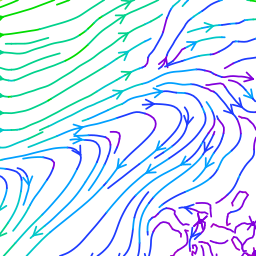
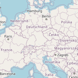
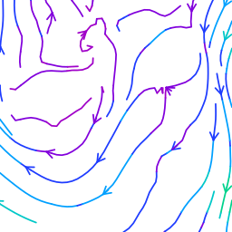
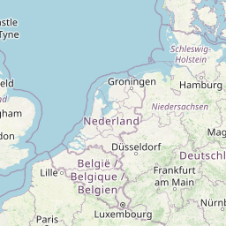
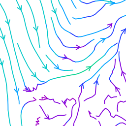
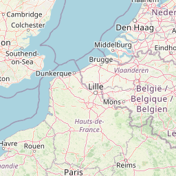
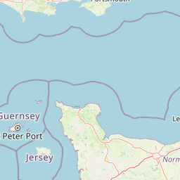
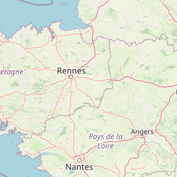
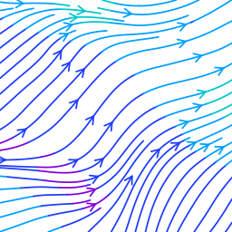
Example with zoom 4:
Picture top left, background: https://a.tile.openstreetmap.org/4/7/5.png
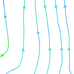
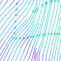
API request for the picture top left, foreground:
https://weather.openportguide.org/api/wthr/graphic/tile/?var=windStream&zoom=4&X=7&Y=5×tep="0h"&apiKey="yourApiKey"
  |
  |
  |
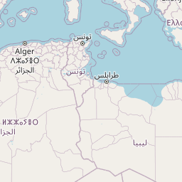  |
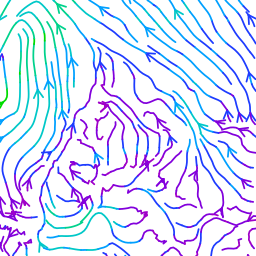
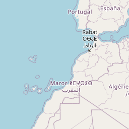
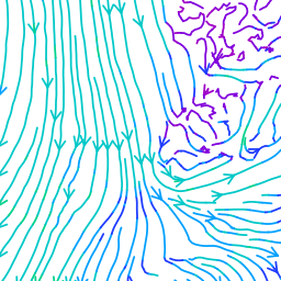
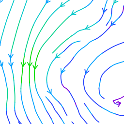
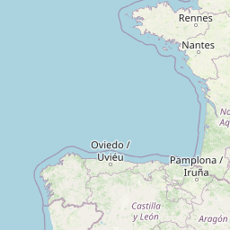
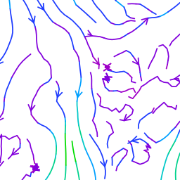
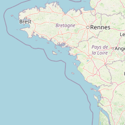
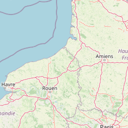
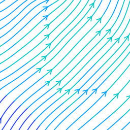
Example with zoom 5:
Picture top left, background: https://a.tile.openstreetmap.org/5/15/10.png
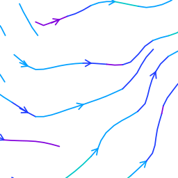
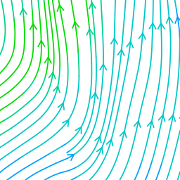
API request for the picture top left, foreground:
https://weather.openportguide.org/api/wthr/graphic/tile/?var=windStream&zoom=5&X=15&Y=10×tep="0h"&apiKey="yourApiKey"
  |
  |
  |
  |
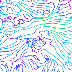
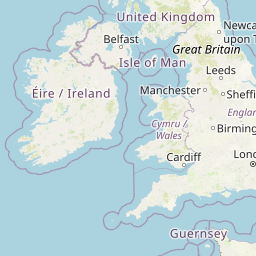
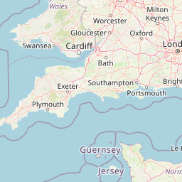
Example with zoom 6:
Picture top left, background: https://a.tile.openstreetmap.org/6/31/21.png
API request for the picture top left, foreground:
https://weather.openportguide.org/api/wthr/graphic/tile/?var=windStream&zoom=6&X=31&Y=21×tep="0h"&apiKey="yourApiKey"
  |
  |
  |
  |
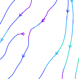
Example with zoom 7:
Picture top left, background: https://a.tile.openstreetmap.org/7/63/43.png
API request for the picture top left, foreground:
https://weather.openportguide.org/api/wthr/graphic/tile/?var=windStream&zoom=7&X=63&Y=43×tep="0h"&apiKey="yourApiKey"
  |
  |
  |
  |